Thanks to the generous support of our Tag Team we will be able to purchase additional satellite tags and learn more about sharks in the Pacific. But why is this so important? Research Director, Vinay Udyawer, breaks down the questions: what are satellite tags, how do they work, and how do we use the information to protect sharks?
What are satellite tags?
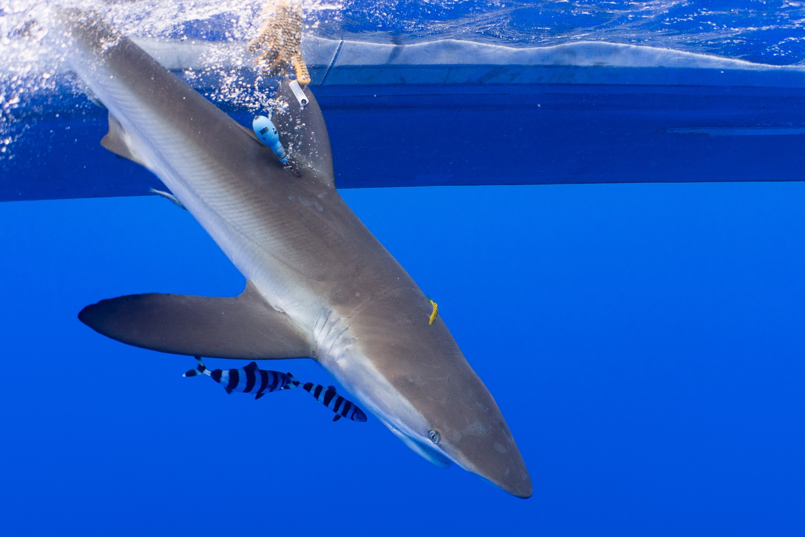
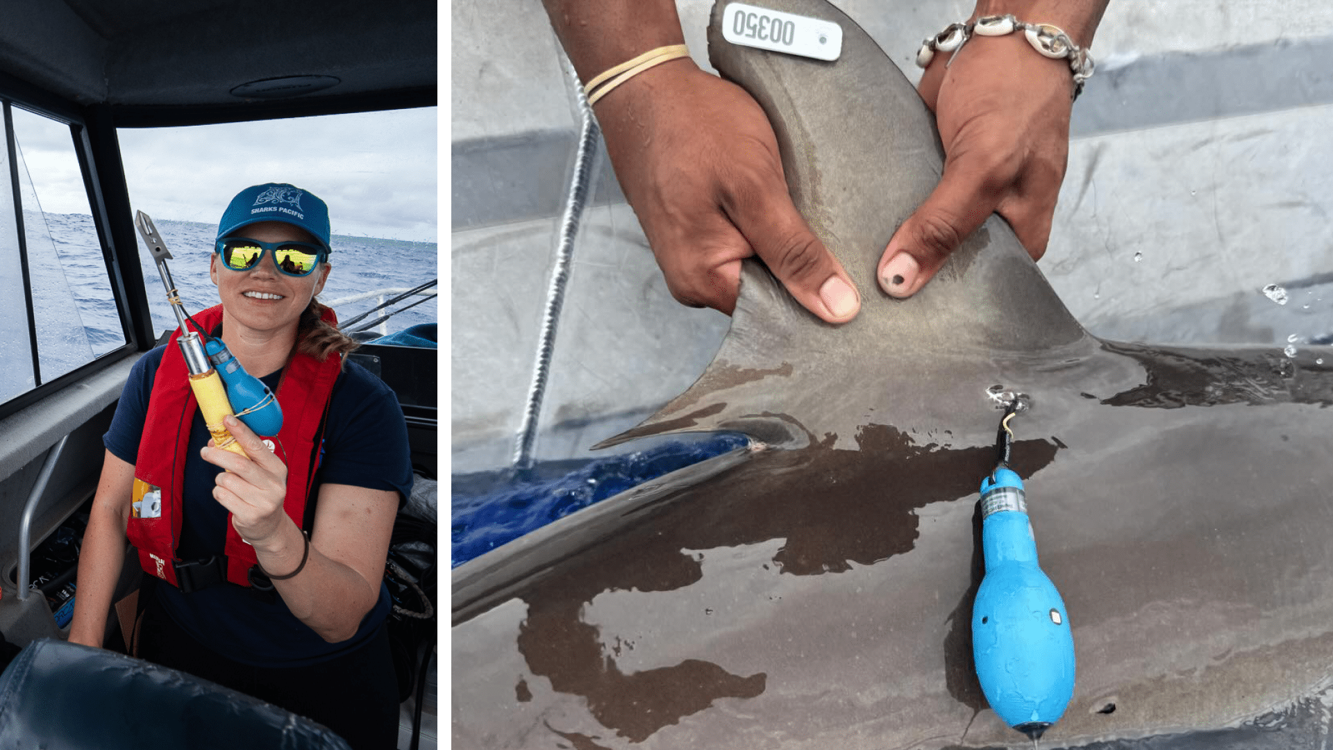
The tags we use to track our sharks are called Pop-up Satellite Archival Tags (PSATs). PSATs are used to track many numbers of species in the ocean, especially species that don’t break the surface of the water regularly. These tags are light (~70g; ~2.5oz) and have one point of attachment to the shark, making them comparatively less invasive than other fin-mounted tags.
How do PSATs work?
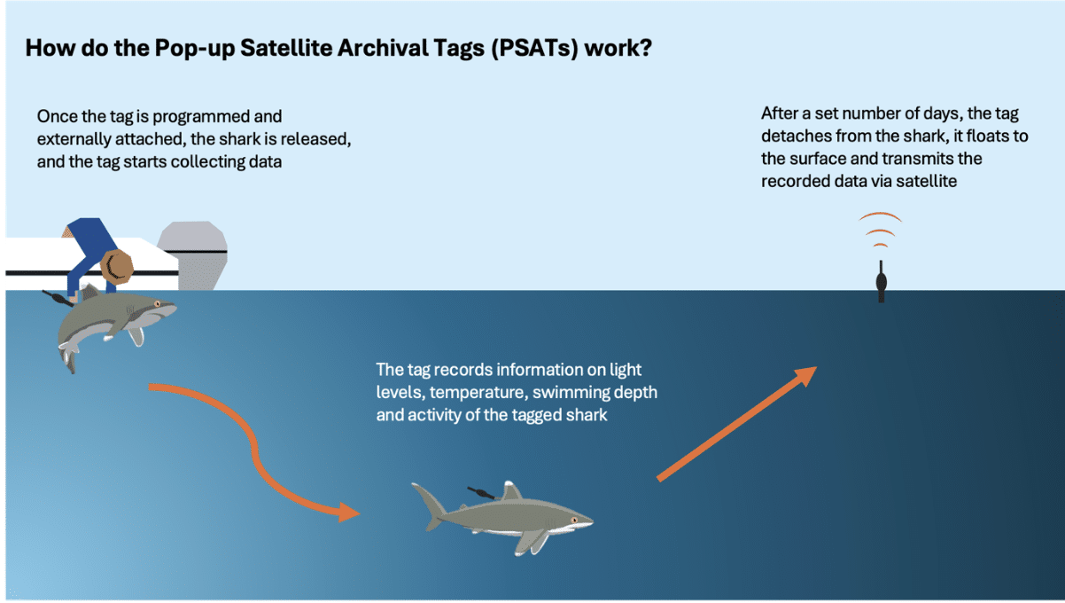
Unlike GPS devices that continuously link up with satellites and can provide live positions, PSATs record and store data for a pre-set period of time (6–12 months) before they ‘pop off’ the shark and transmit all the data. This also means that the tags are only on the shark for that set period and don’t have long-term effects or hinder swimming ability.
While attached to the shark, the tag collects four main streams of data:light levels, temperature, pressure (or depth), and activity levels. These data are collected at a predetermined rate (once every 12 or 24 hours) and stored onboard the tag. Once detached from the shark, the tag floats to the surface and transmits all its data back to us via satellites.
Once we have the data, we can use the light level data to estimate its movement track. Did you know, you can estimate where you are in the world by carefully tracking light levels during the day? By identifying sunrise, sunset, and local midday from the light data, we can estimate broad-scale longitude and latitude for each day. Because sharks dive and often spend time below the surface, where light levels drop or shift, the data is adjusted to account for depth and turbidity recorded by the tag. We use these corrections, along with other statistical models (using the collected temperature and depth data), to help refine the otherwise coarse estimated tracks.
How do we use tracking data to protect sharks?
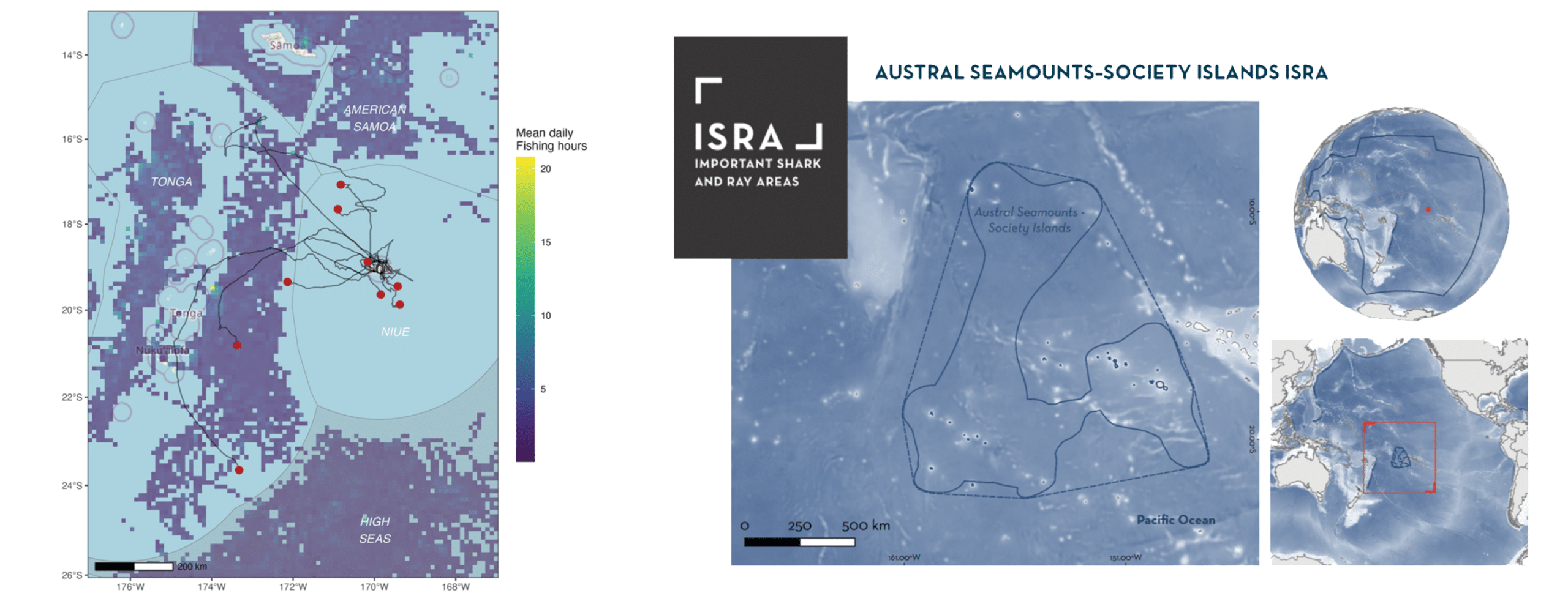
Once the data is processed, the tracking data can be used to understand the movement patterns of our sharks—identifying important habitats, migratory pathways, and how often and deep the shark dive. These tracks can also tell us how long these sharks stay within protected waters of shark sanctuaries or marine protected areas, and how much time they spend in the high seas, where they are exposed to increased fishing pressures.
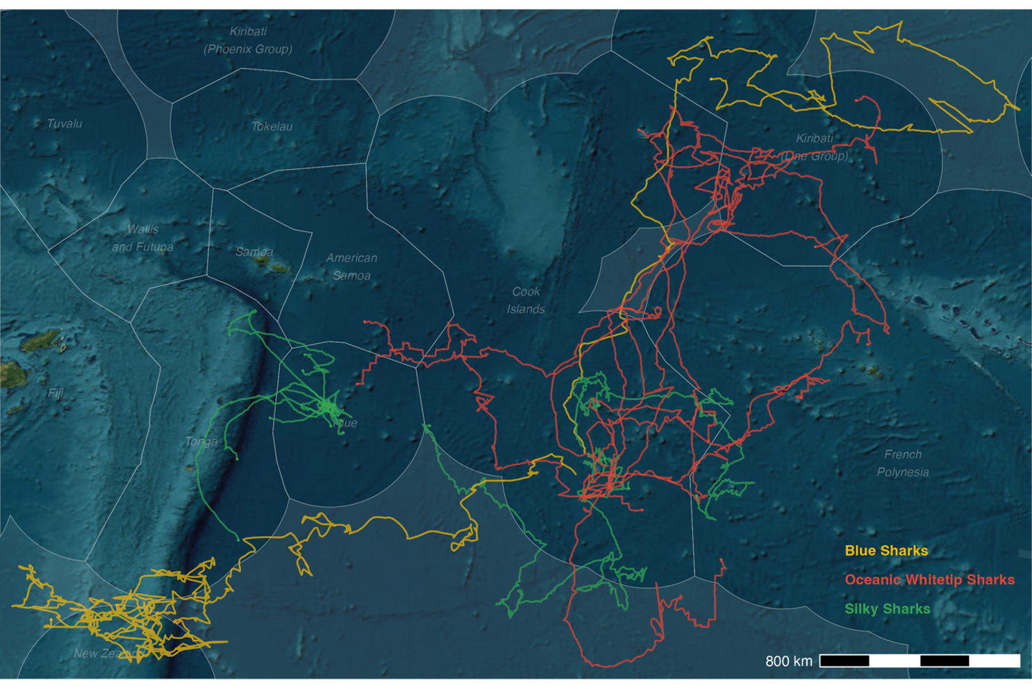
The tracking data is also overlayed with fishing effort data collected by other sources like Global Fishing Watch, to identify what levels of risk sharks face as they move between important habitats, or across jurisdictional boundaries. This analysis helps identify not only how they overlap with the footprints of fishing vessels, but the depth data collected by the tags can also help us understand what their vulnerability is to deep or shallow set fishing gear.
This information alongside national level data on fisheries catches, can inform how local and international fisheries are managed. Data on post-release behaviour can also provide important measures of post-release survival that can help develop more accurate stock assessments for data-poor shark species (like Oceanic Whitetip Sharks and Silky Sharks) in the Pacific. The movement data Sharks Pacific has collected on Oceanic Whitetip Sharks has also been used to help develop Important Shark and Ray Areas (ISRAs) for this species in the Central Pacific.
Together, all this work gives us a much clearer picture of how sharks use the vast Pacific, and how we can better protect them. Every tag you help us deploy adds another piece to that puzzle, revealing where sharks travel, how they behave, and what risks they face along the way. These insights directly support stronger management decisions, more effective shark sanctuaries, and international conservation efforts that span far beyond any single island or nation. Your support isn’t just helping us purchase tags; it’s helping us safeguard the future of these incredible animals and the ecosystems that depend on them.